
Post Falls council to decide whether a downtown alley strip is public land
A Nov. 17 public hearing will look at 3,854 square feet at the east end of West Alley Street. Here's what "right-of-way validation" means and how to speak up.
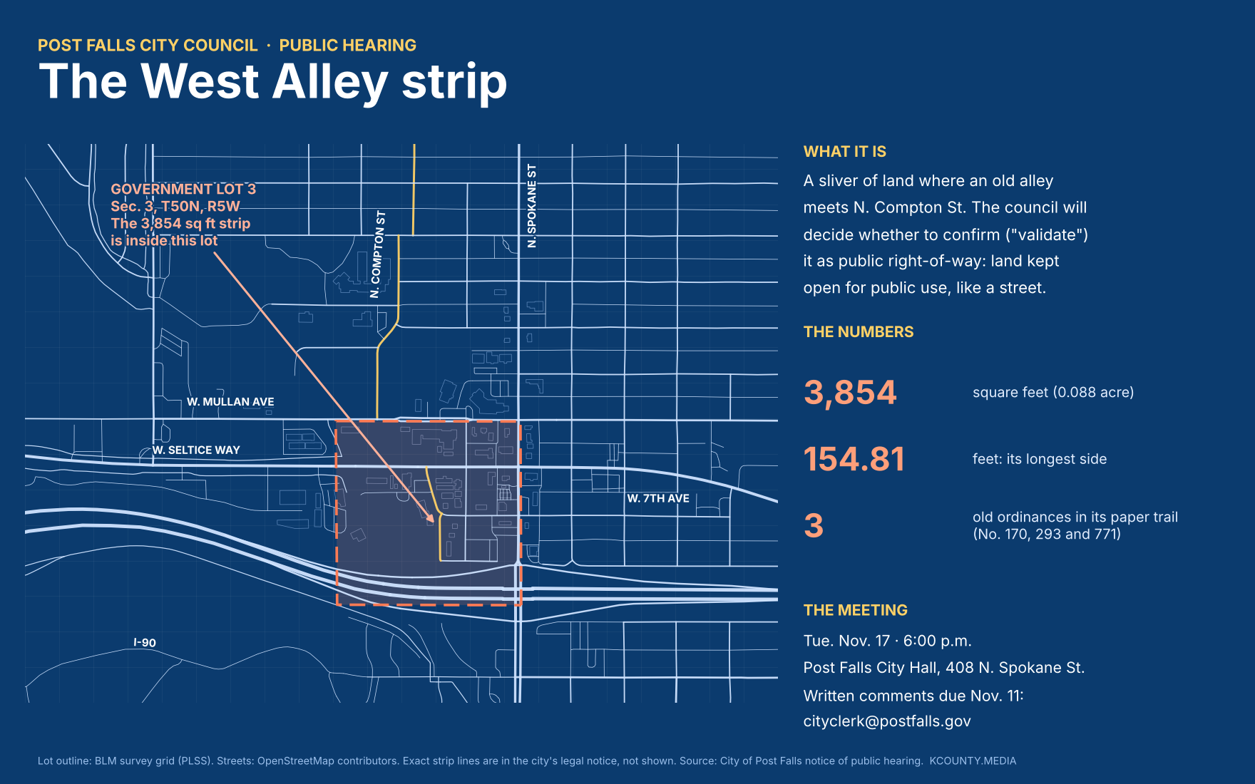
On Tuesday, Nov. 17, the Post Falls City Council will hold a public hearing on a small strip of land with a long paper trail: the easternmost end of West Alley Street, near North Compton Street.
What a right-of-way is
A right-of-way is land kept open for the public to use, like a street, alley or sidewalk. The public has the right to pass over it, even if it sits next to private property.
Over the years, cities "vacate" right-of-way they no longer need. That means they give up the public's claim, and the land usually goes to the owners next door. Post Falls has done that around this spot more than once.
What "validation" means
Idaho law (Idaho Code 40-203A) gives city councils a tool for when there's doubt about whether a road or alley was ever legally set up as public. It's called validation. The council looks at all the evidence, hears from anyone with an interest, and then decides whether the strip is, or should be, public right-of-way. If the council validates it, the order is recorded with the county.
In plain English: the council is being asked to settle, on the record, that this piece of land is public.
The strip
The city's notice describes the land down to the inch. It is 3,854 square feet, about 0.088 of an acre. Its longest side runs 154.81 feet. It sits in Government Lot 3 of Section 3, Township 50 North, Range 5 West, which is the downtown block area along North Compton Street between Mullan Avenue and Interstate 90.
Its paper trail runs through three older city ordinances that vacated nearby land: No. 170 and No. 771, both about Compton Street, and No. 293, about the alley of Block 4 in the old West Fairview and East Fairview Addition. The new strip lies inside the area Ordinance 293 vacated.
The notice doesn't say who asked for the validation or why, and it includes no staff recommendation. We'll update this story when the council packet is posted.
What happens at the meeting
The council will hear the request, take public testimony and consider the evidence. Then it can vote to validate the strip as public right-of-way, or not.
How to weigh in
Go in person: Tuesday, Nov. 17, at 6 p.m., Post Falls City Hall, 408 N. Spokane St.
Send written comments by Wednesday, Nov. 11: mail to City of Post Falls, 408 N. Spokane St., Post Falls, ID 83854; email cityclerk@postfalls.gov; or use the form on the city's West Alley page.
Sources
- City of Post Falls: West Alley Right-of-Way Validation
- City of Post Falls: notice of public hearing (PDF)
- Coeur d'Alene Press legals, Nov. 7, 2026
- Idaho Code 40-203A: validation of public right-of-way
- Idaho Legislature 2009 H0196: gives city councils validation authority
- BLM survey grid (PLSS), Section 3, T50N R5W
- OpenStreetMap contributors